More services
On this page you will find additional visual services that complement our core 3D virtual tours. These solutions are designed to enhance presentation, provide accurate spatial data, and create strong visual impact from the ground and from the air. From building 3D scanning and aerial panoramas to drone photography and Google Maps integration with custom icons, each service helps you showcase your space more clearly and professionally. Below, you can explore a gallery of selected works demonstrating these services in real projects.
Building 3D scan
360° aerial drone panorama
Drone photography
Beloved Real Estate photo from our USA partner
Google Map with your icons
See more of our photos below
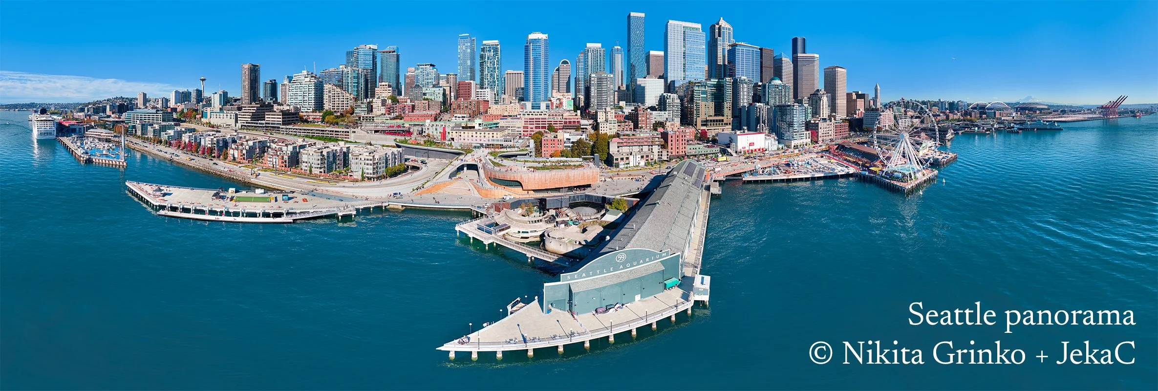
The panorama is made from about 70 images in total and has a resolution of 1.42 giga pixels. This amazing work was created in collaboration with my colleague JekaC. Thank you men, you're awesome!
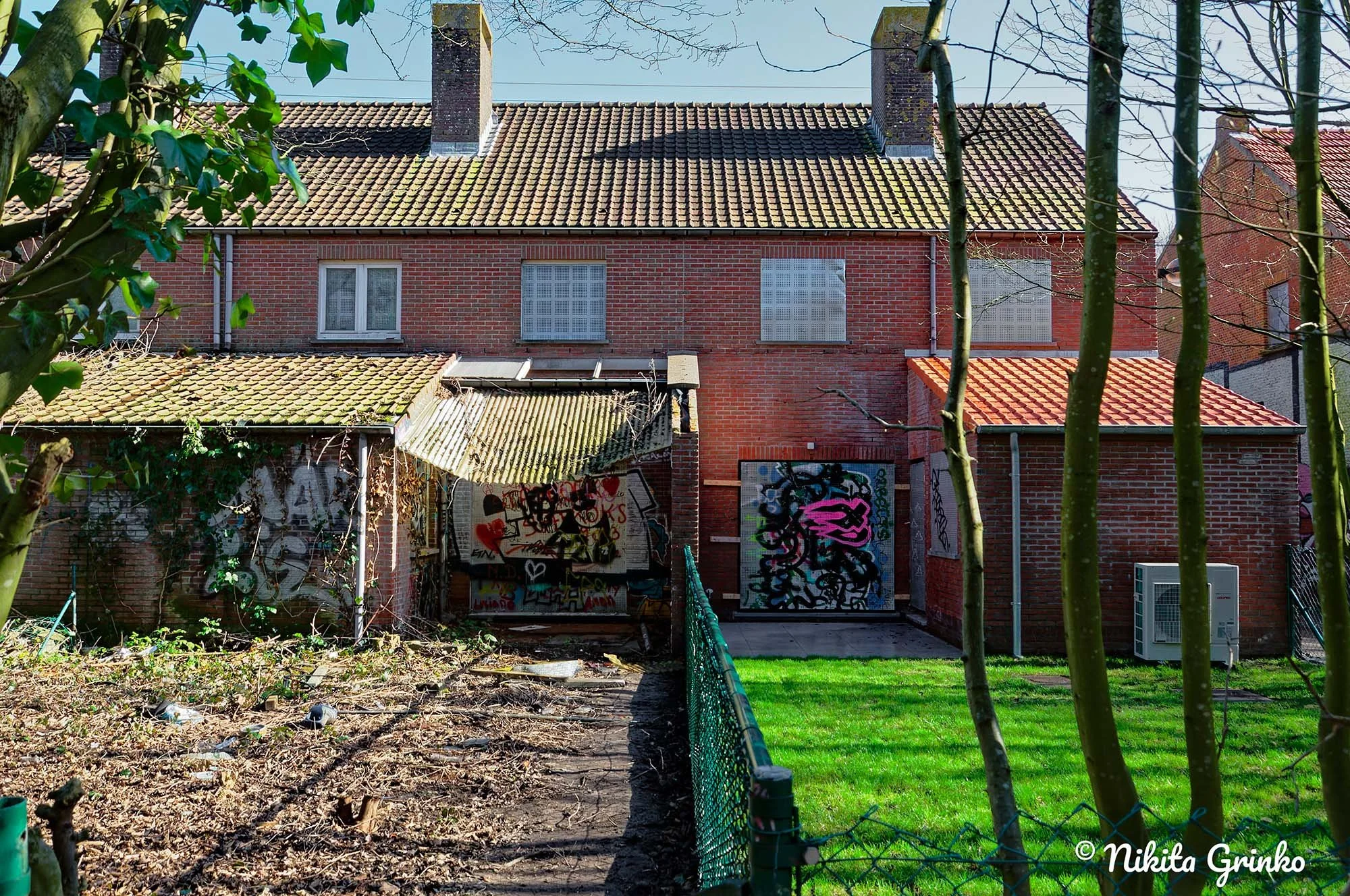
Backyard view with a brick house, graffiti-covered wall, garden, and trees.
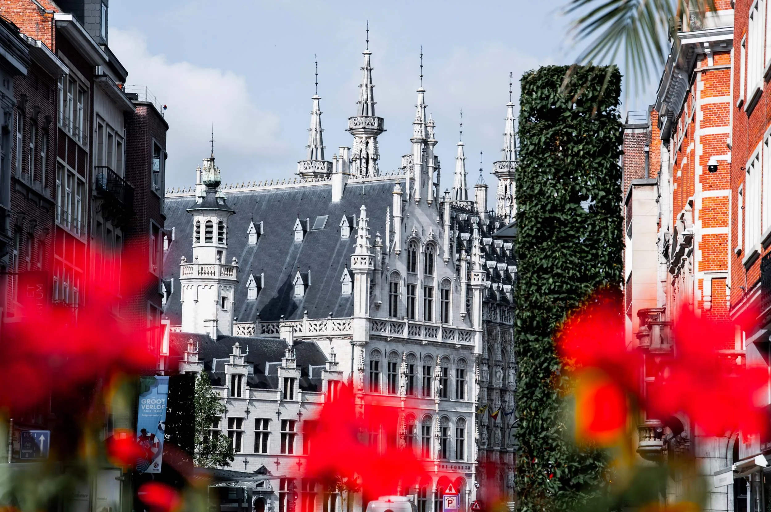
A historic European building with ornate gothic turrets and spires, surrounded by modern buildings and greenery, under a partly cloudy sky.
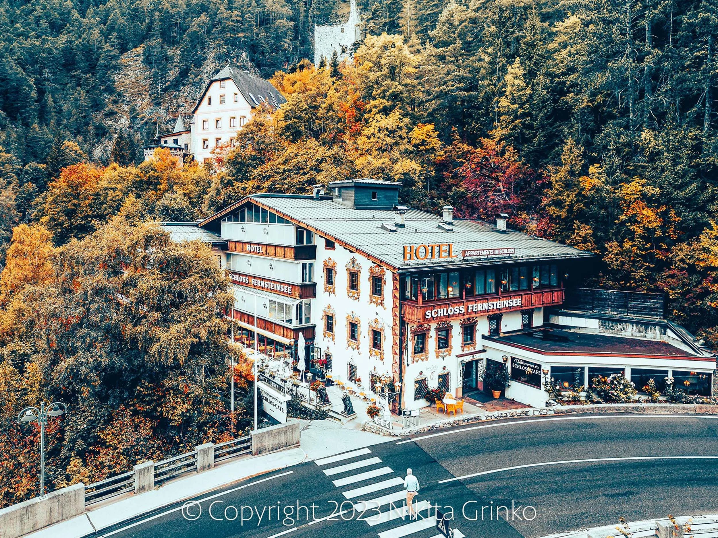
A scenic view of a hillside hotel with a castle-like structure on the mountain behind it, surrounded by autumn foliage and a winding road at the bottom with a person walking across a crosswalk.
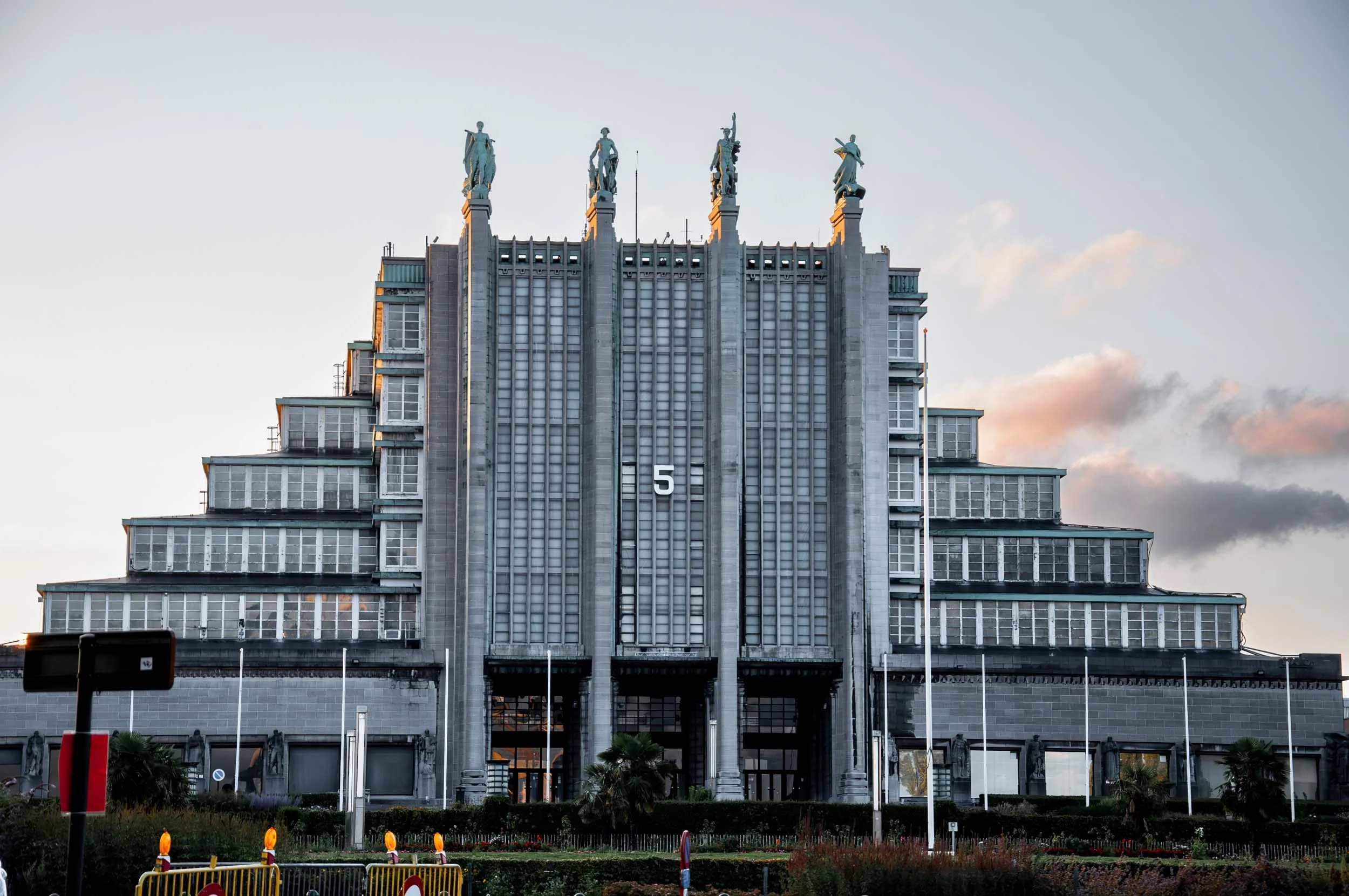
A tall, modern building with multiple levels and a clock on its front. Statues of people are on the top of the building, and there are decorative elements at the base. The sky is partly cloudy with a soft evening light, and there are some palm trees and a fence at the foreground.
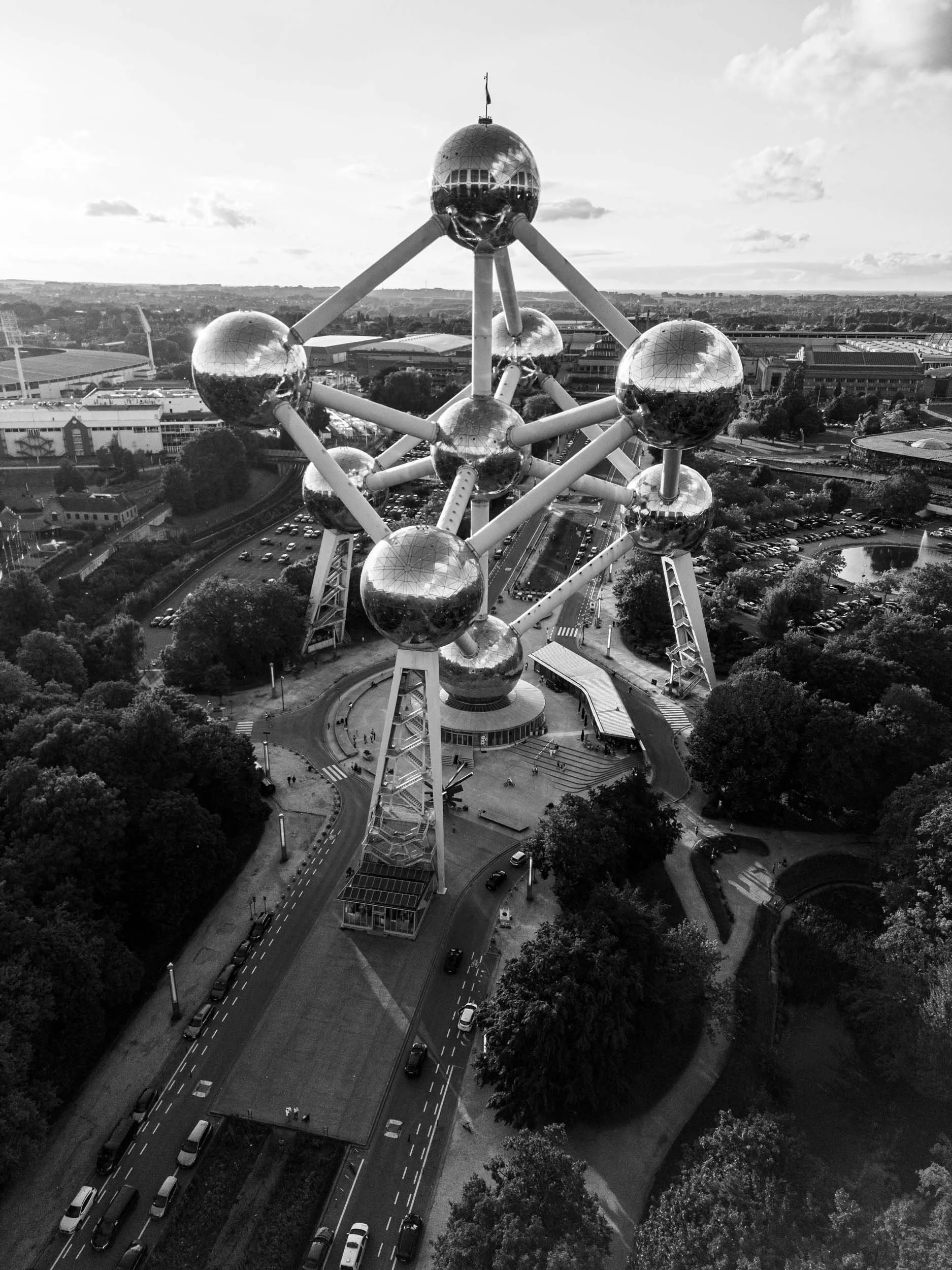
Black and white aerial view of the Atomium, a landmark building in Brussels, Belgium, with surrounding roads, cars, trees, and cityscape in the background.
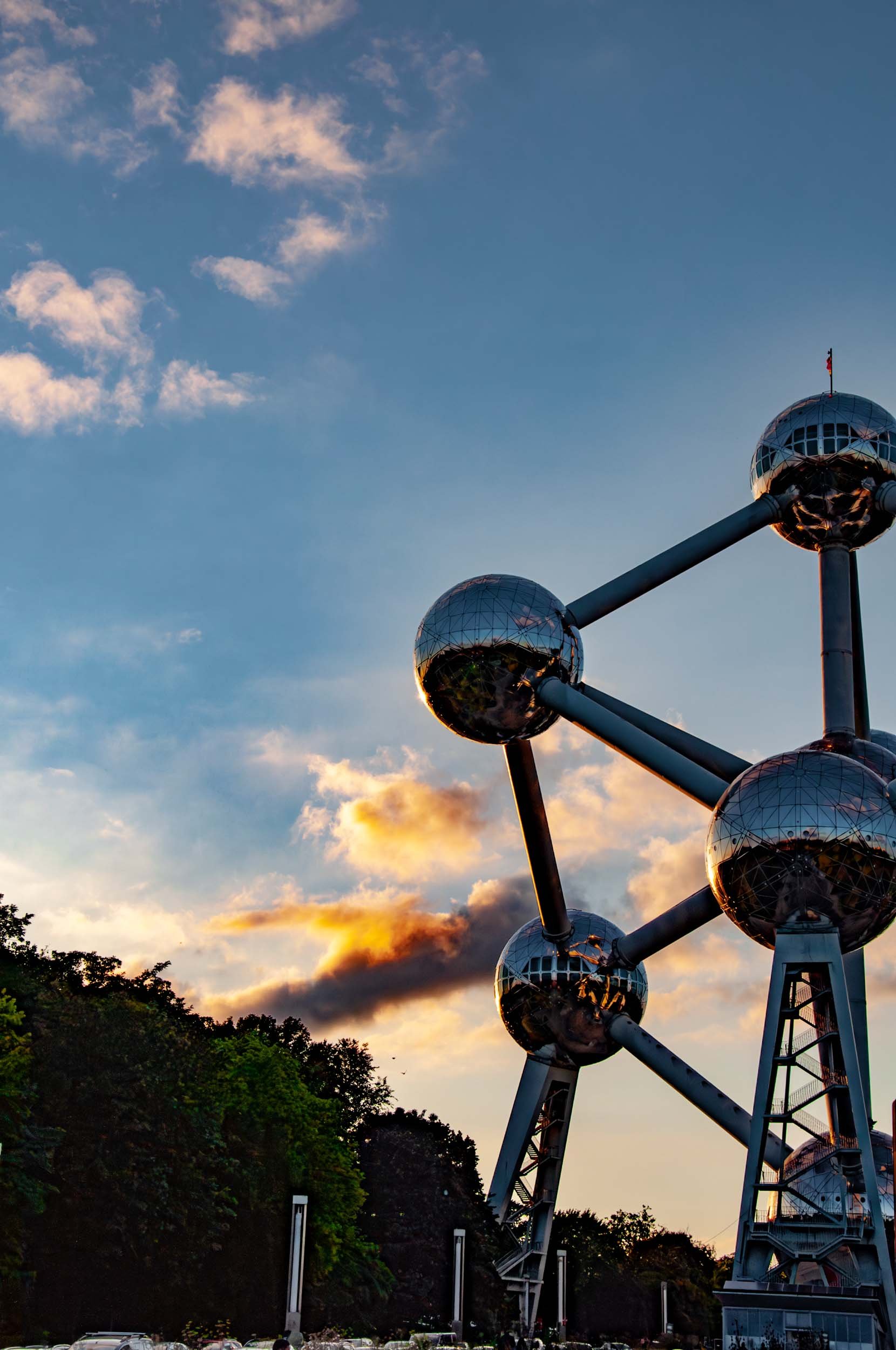
The image shows the Atomium, a famous landmark in Brussels, Belgium, with a sunset sky and scattered clouds in the background. The structure consists of interconnected metallic spheres and tubes, with some reflections on the spheres. Trees and parked cars are visible at the base of the structure.
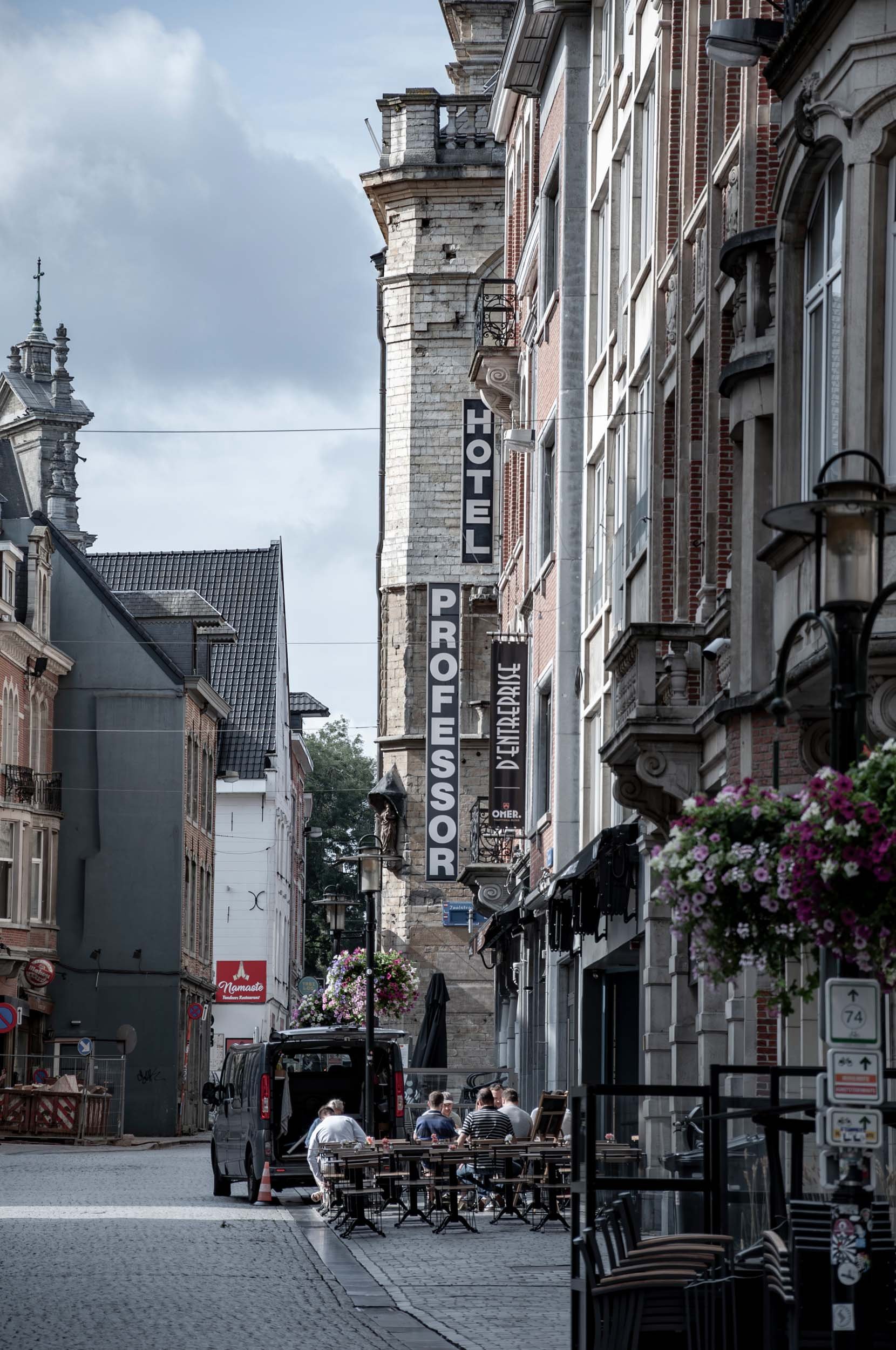
Street view of a European city with outdoor cafes, flower baskets, and multiple hotels signages on the buildings. People sit at outdoor tables, cars parked along the street, historic buildings, and cloudy sky.
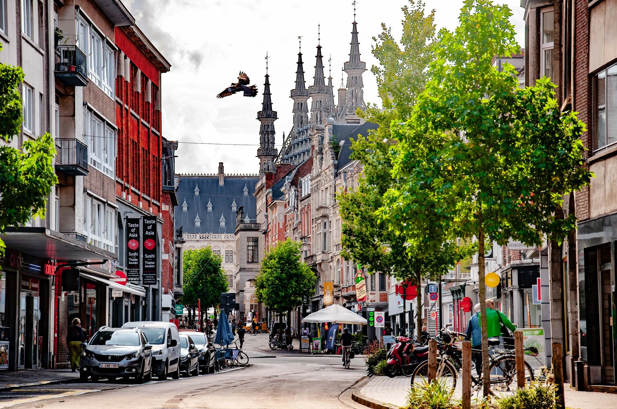
A busy city street lined with buildings and trees, with cars, bicycles, pedestrians, and outdoor cafe seating, against a backdrop of historic architecture with spires.
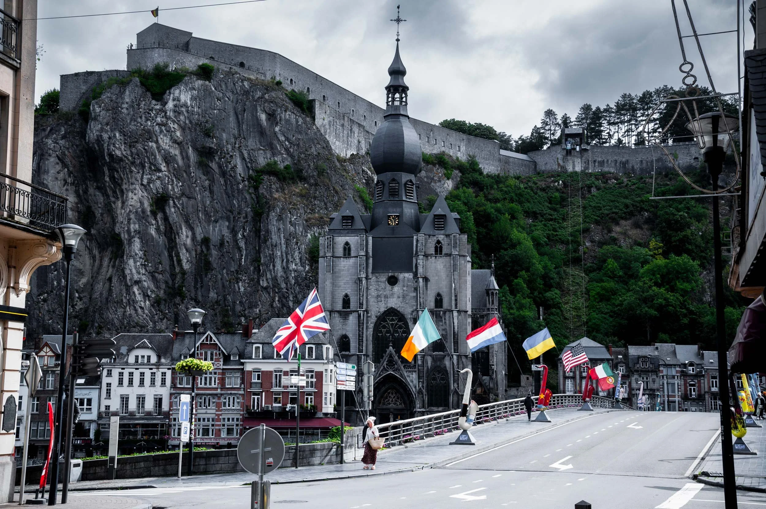
A small town with a church at the base of a steep hill or mountain. The church has a black steeple and gothic style windows. Flags from various countries line the waterfront promenade, and a woman is walking across the street carrying a basket. Overcast sky.
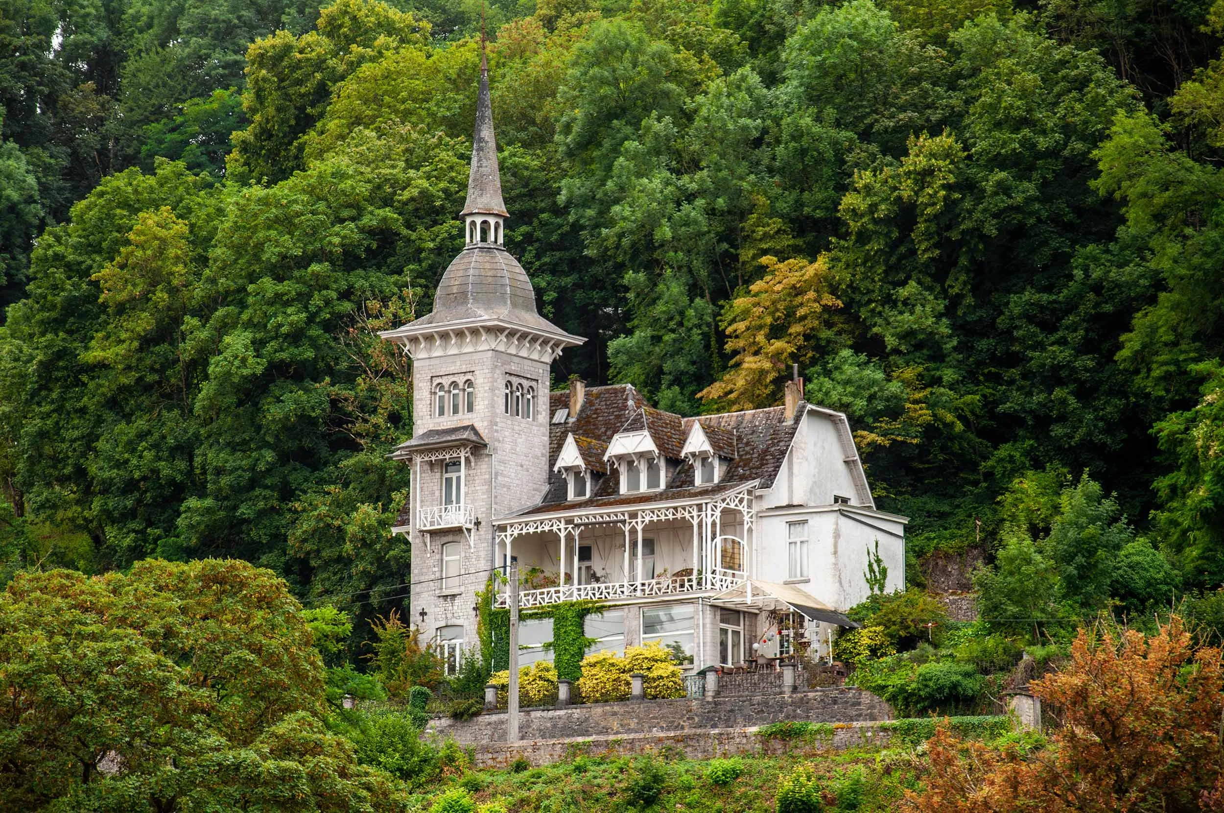
A large white Victorian-style house with a tall, pointed tower, surrounded by dense green trees and plants.
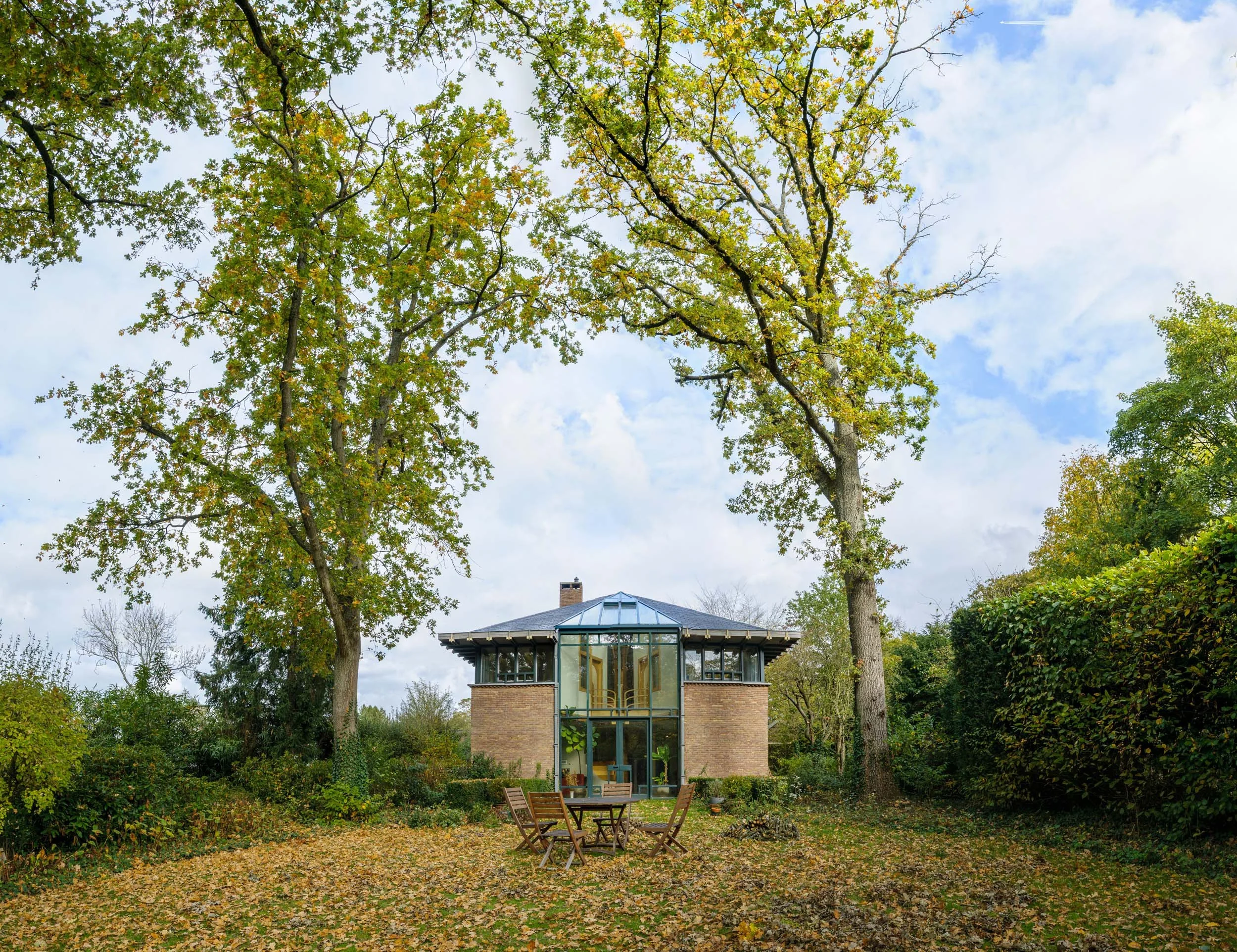
A modern house with glass walls and a brick facade is situated in a garden surrounded by tall trees with autumn leaves falling on the ground.
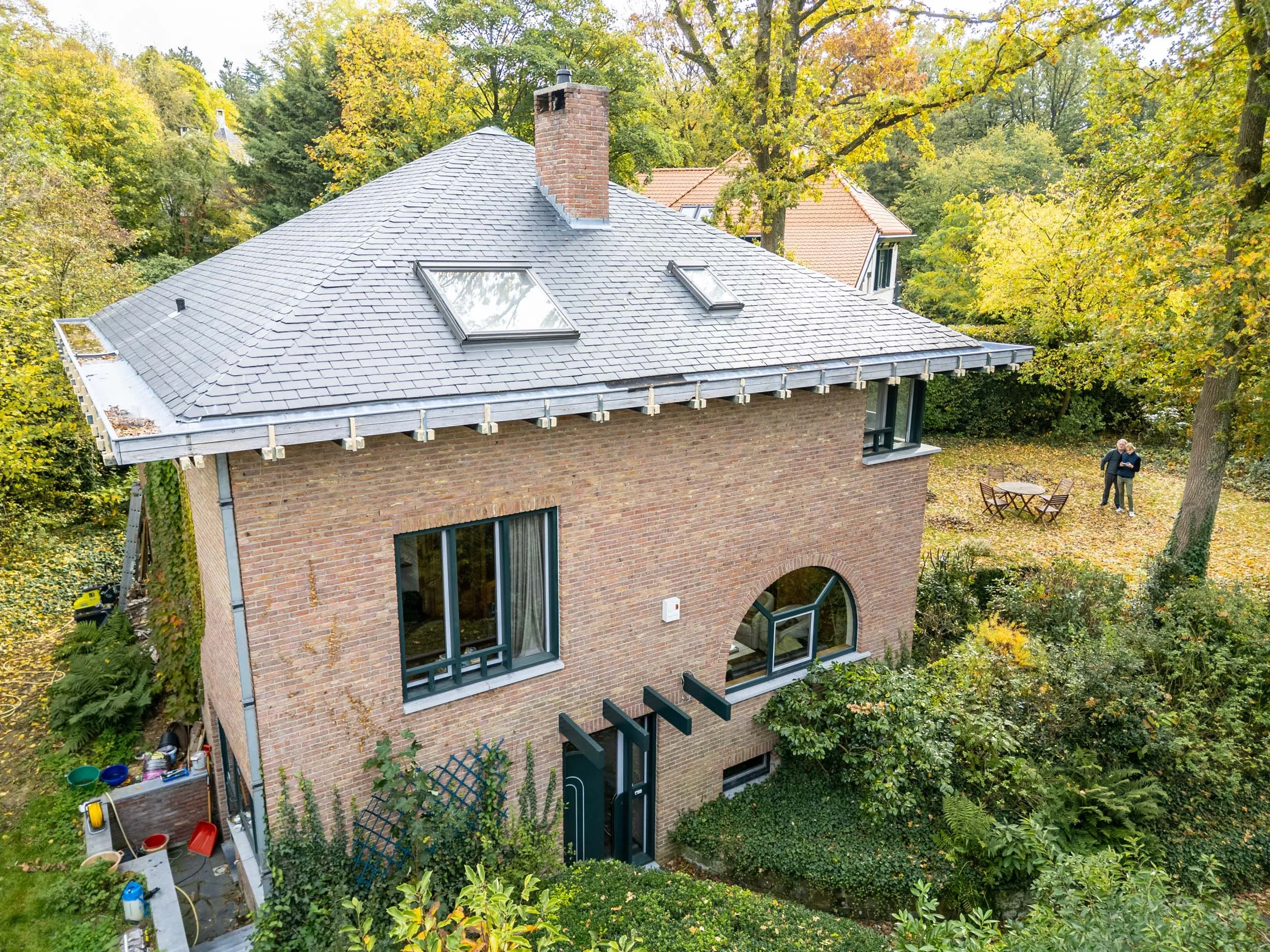
A multi-story brick house with a gray tiled sloped roof, two skylights, and a tall brick chimney, surrounded by green trees with fall foliage, a yard with outdoor furniture and gardening tools.
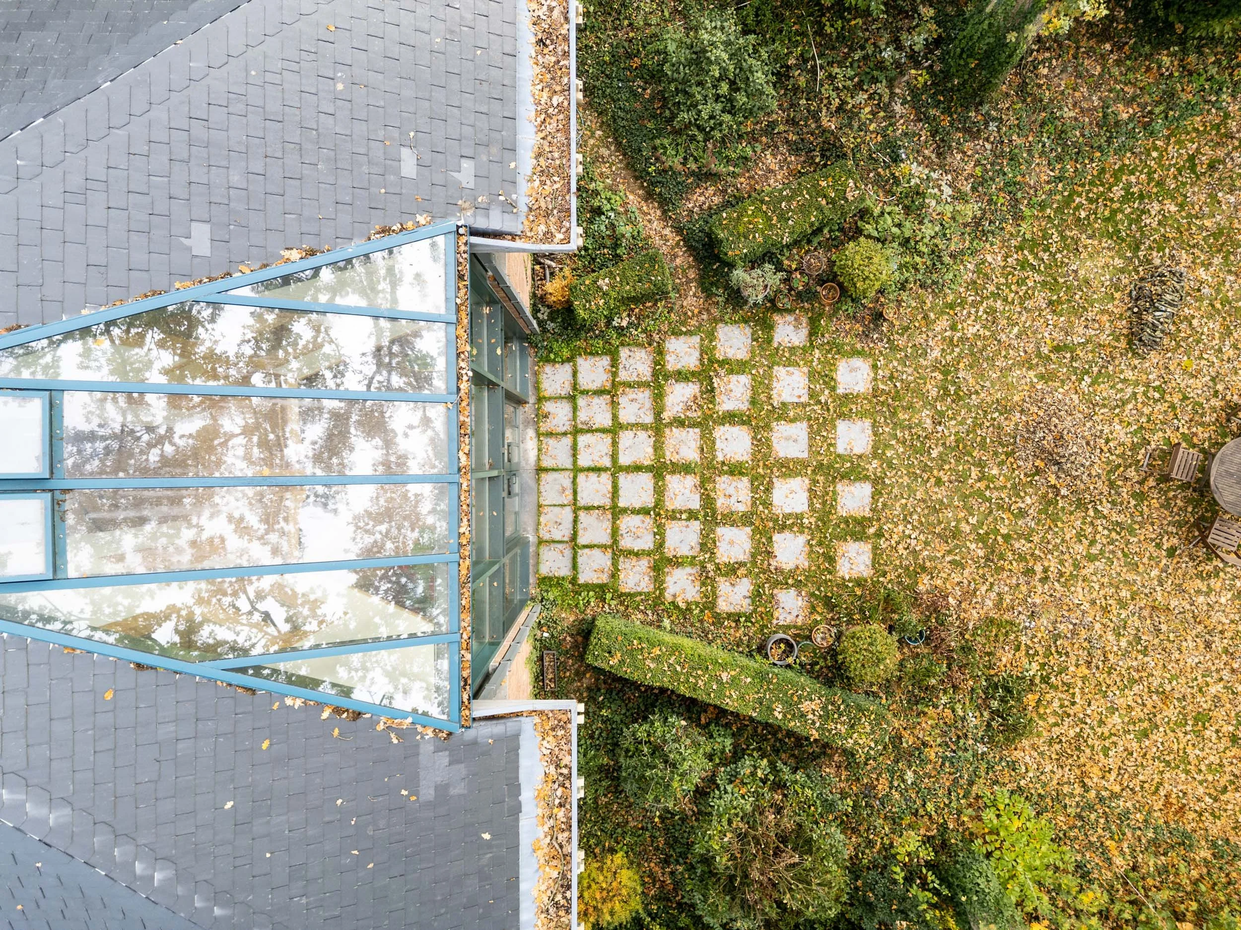
Top view of a house with a gray shingled roof and a glass-roofed sunroom, surrounded by fallen autumn leaves. The yard features a paved pathway and lush green bushes.
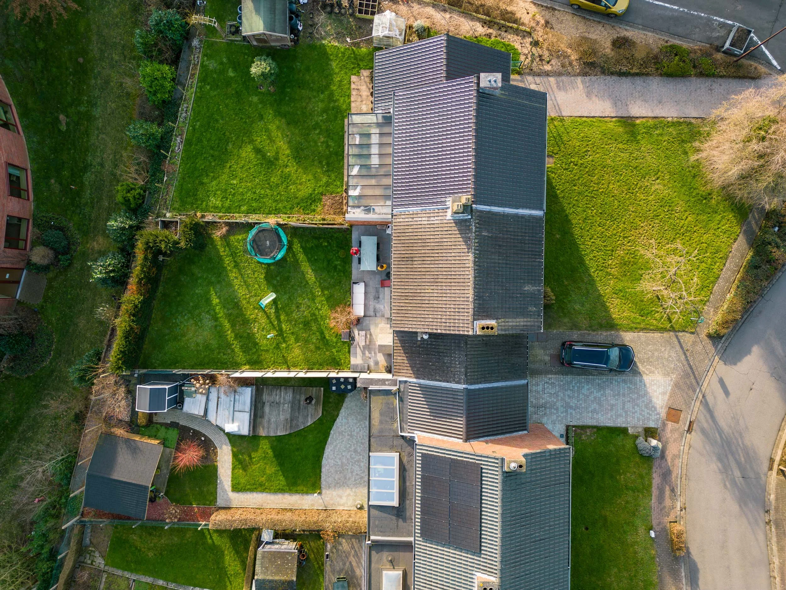
Aerial view of a backyard with green grass, a small trampoline, a shed, and neighboring houses with tiled roofs, roads, and parked cars at the top of the image.
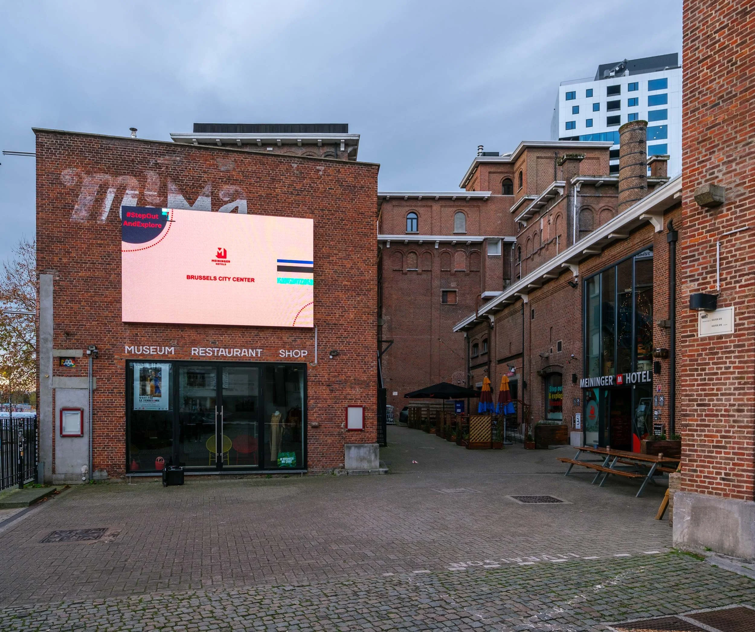
Cityscape with brick buildings, a digital billboard displaying 'Brussels City Center' and a hashtag '#StepOutAndExplore', and a clear cloudy sky.
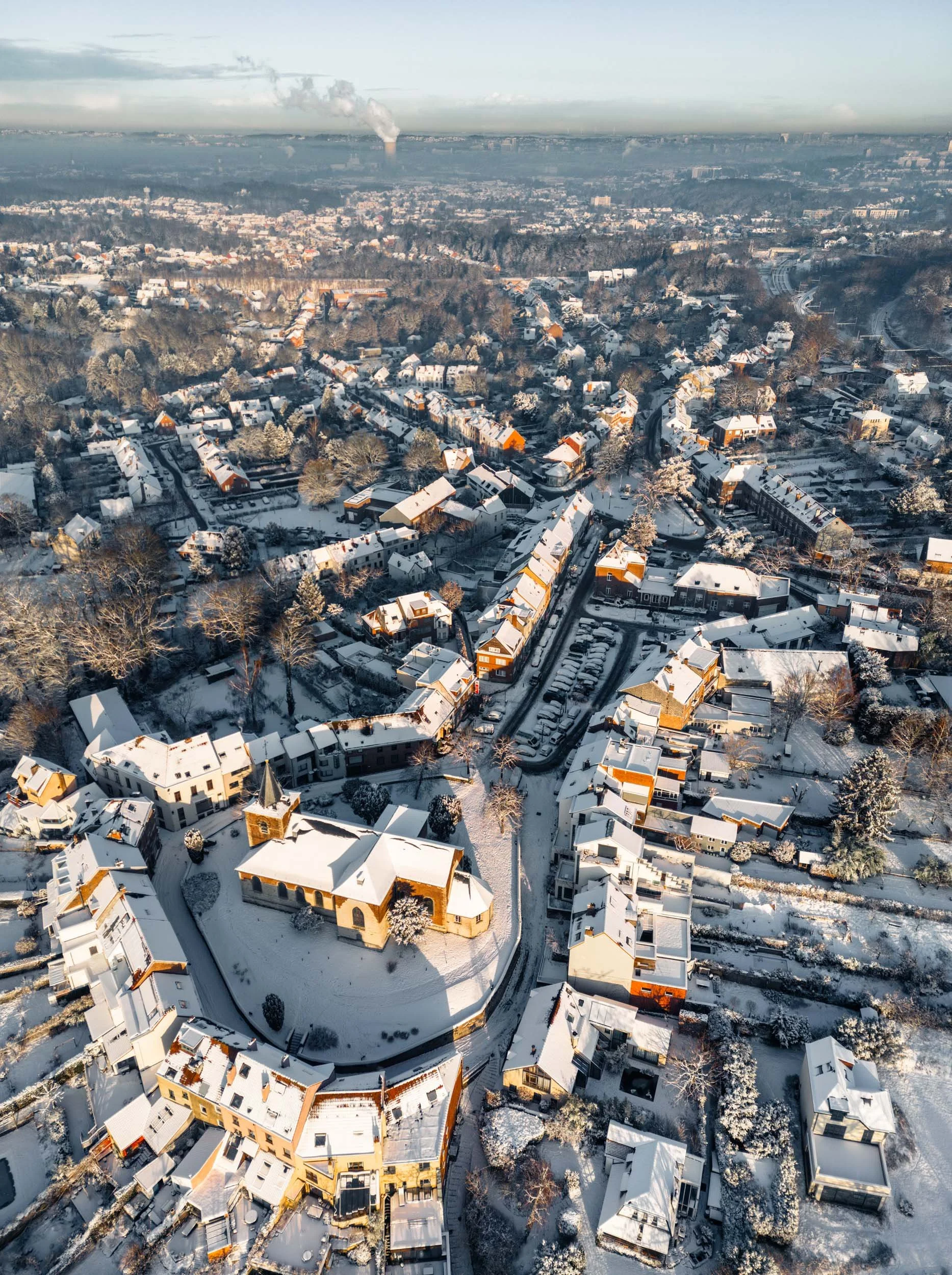
Aerial view of a snow-covered suburban neighborhood with trees and houses, and a church with a steeple in the foreground, during winter with cloudy sky.
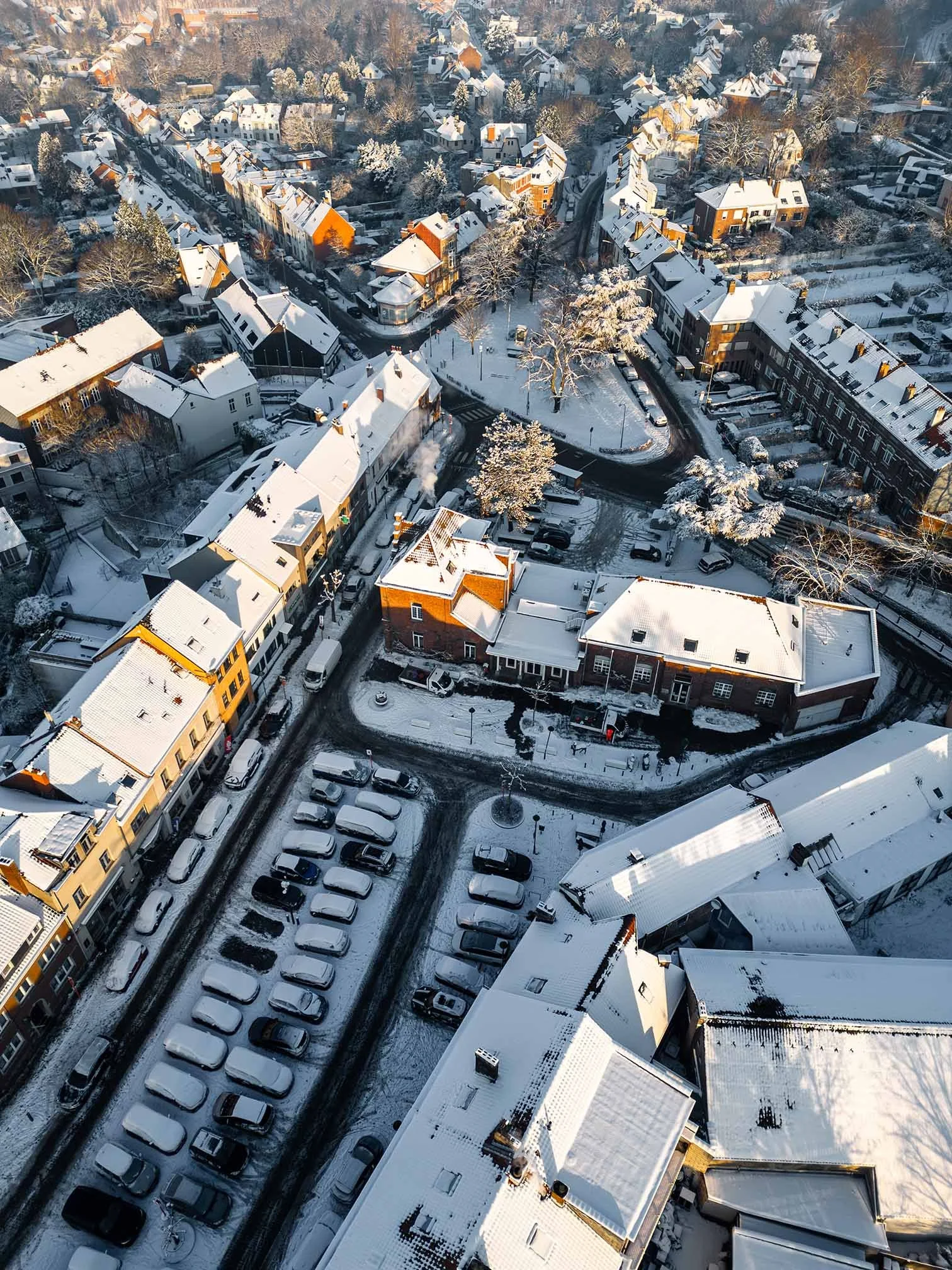
An aerial view of a snow-covered residential neighborhood with a mix of houses and cars along snow-lined streets, trees with snow on their branches, and rooftops blanketed in snow.
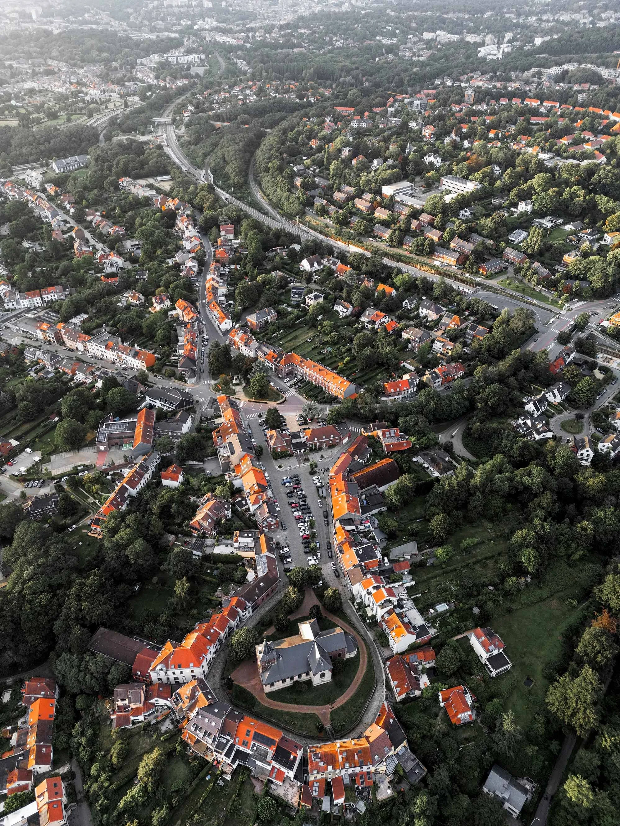
An aerial view of a hilly suburban neighborhood with winding roads, numerous houses with red roofs, and lots of green trees.
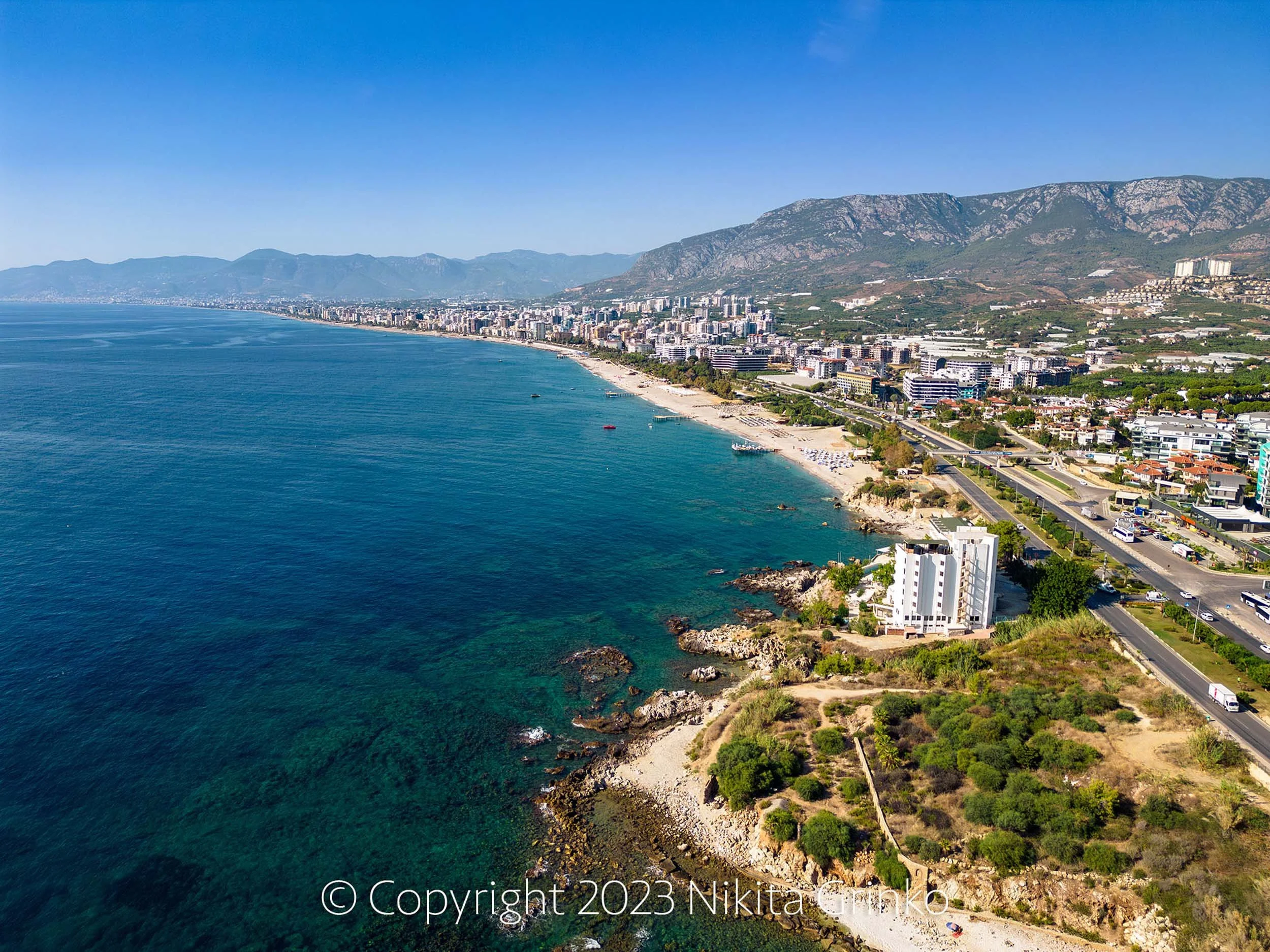
Aerial view of a coastal city with high-rise buildings along the shoreline, mountains in the background, and clear blue water in the foreground.
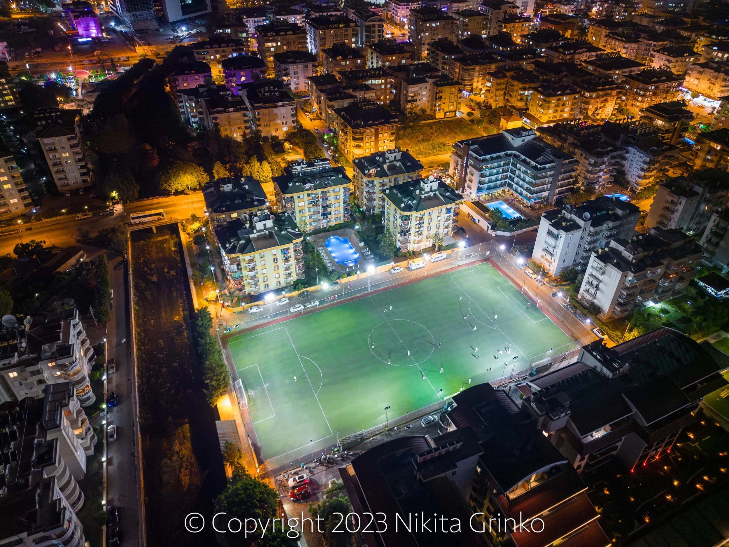
Aerial night view of a city with illuminated buildings and streets. A sports field with players and floodlights is visible in the foreground.
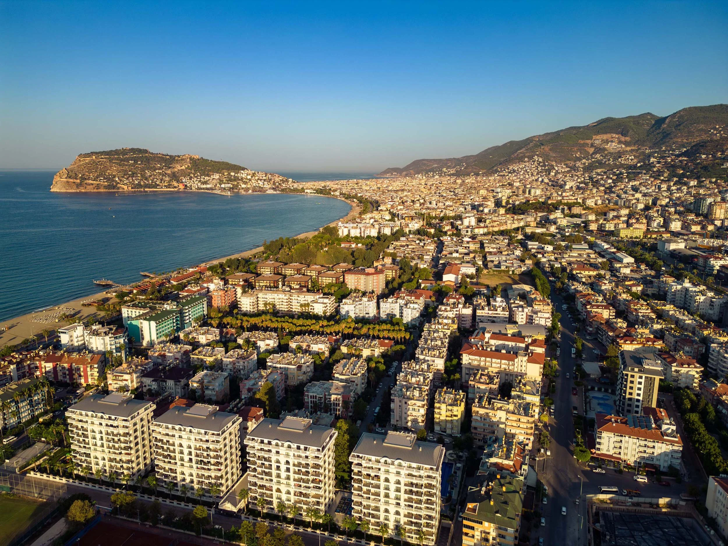
An aerial view of a coastal city with a large bay, high-rise buildings, and a mountainous backdrop. The city is densely populated with various residential and commercial structures, green spaces, and a beach along the shoreline.
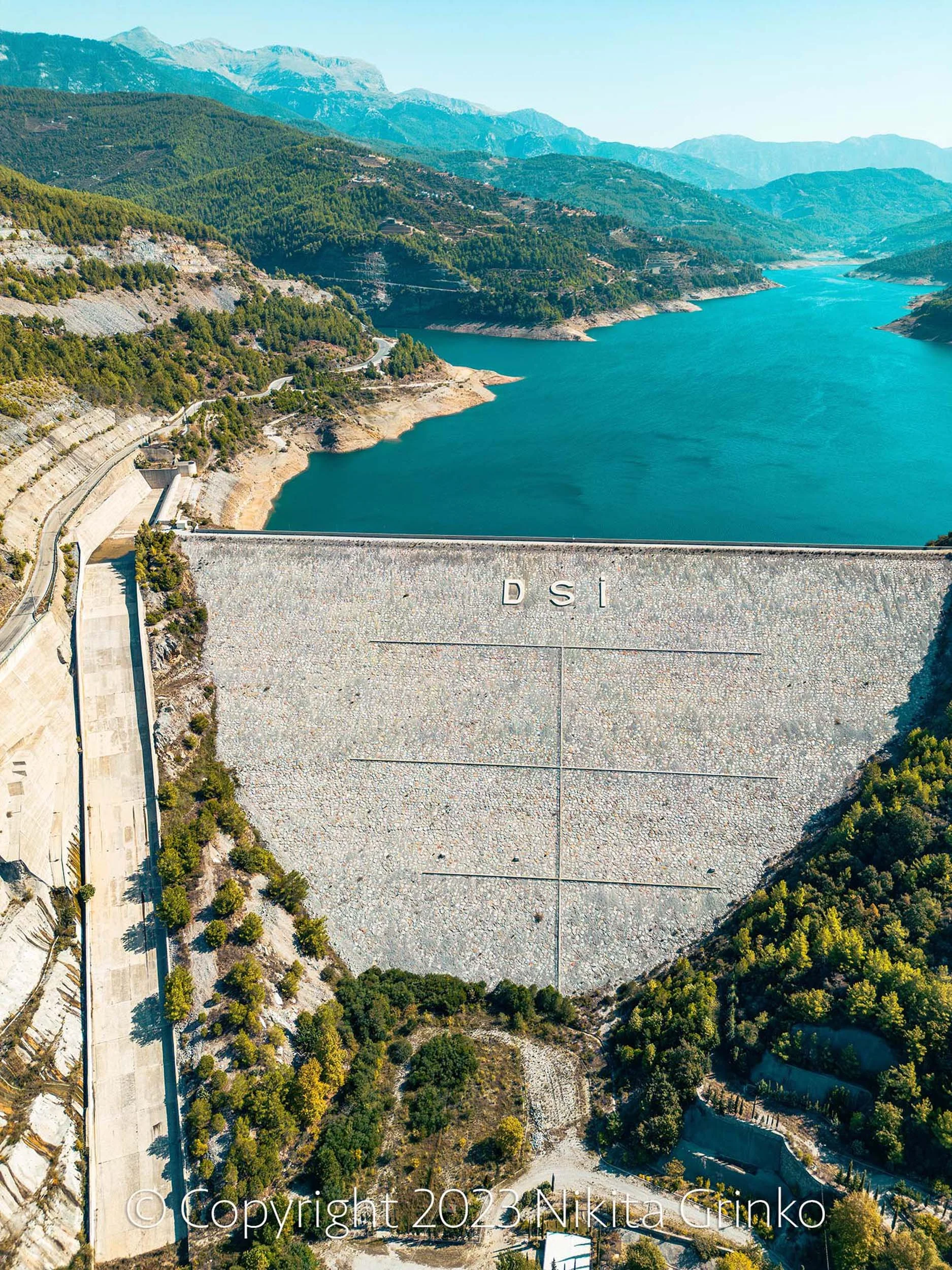
Aerial view of a dam on a river surrounded by mountains and forest, with a road running along the side of the dam.
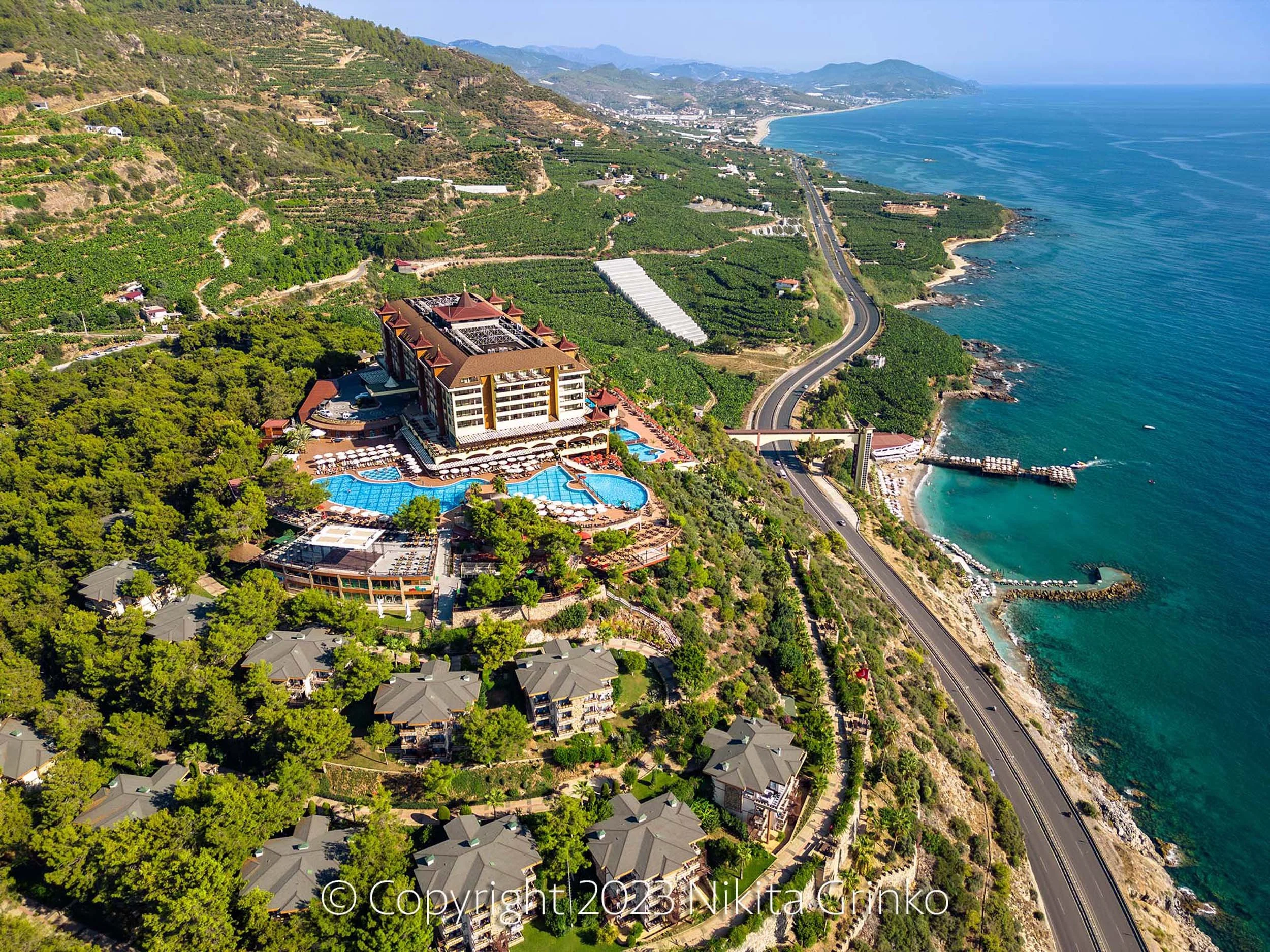
An aerial view of a coastal landscape featuring a large hotel or resort with multiple pools, a nearby winding road, green hills with scattered houses, and the ocean shoreline in the background.
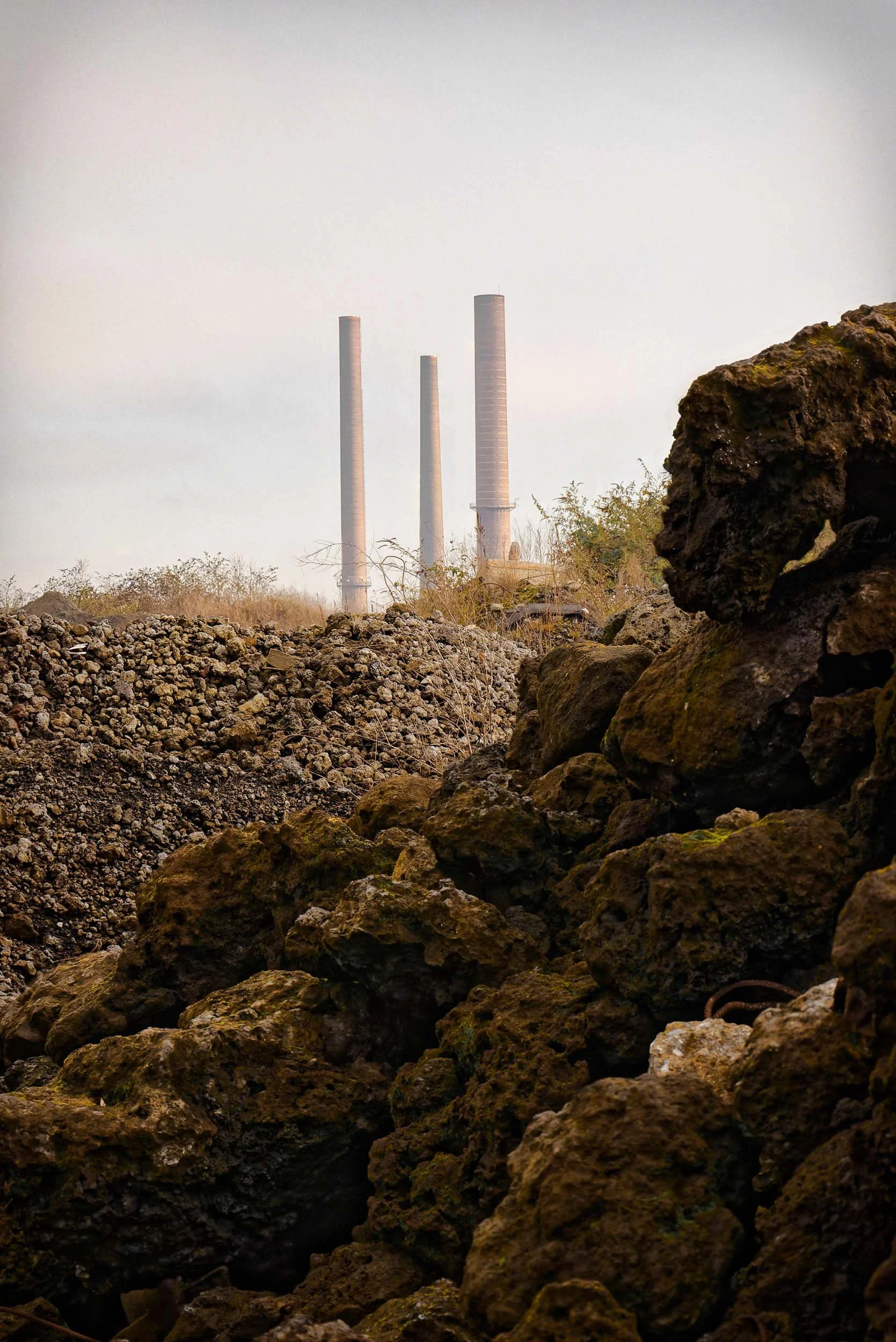
A landscape view with large rocks and dry soil in the foreground, three tall industrial smokestacks in the background, and a pale sky overhead.
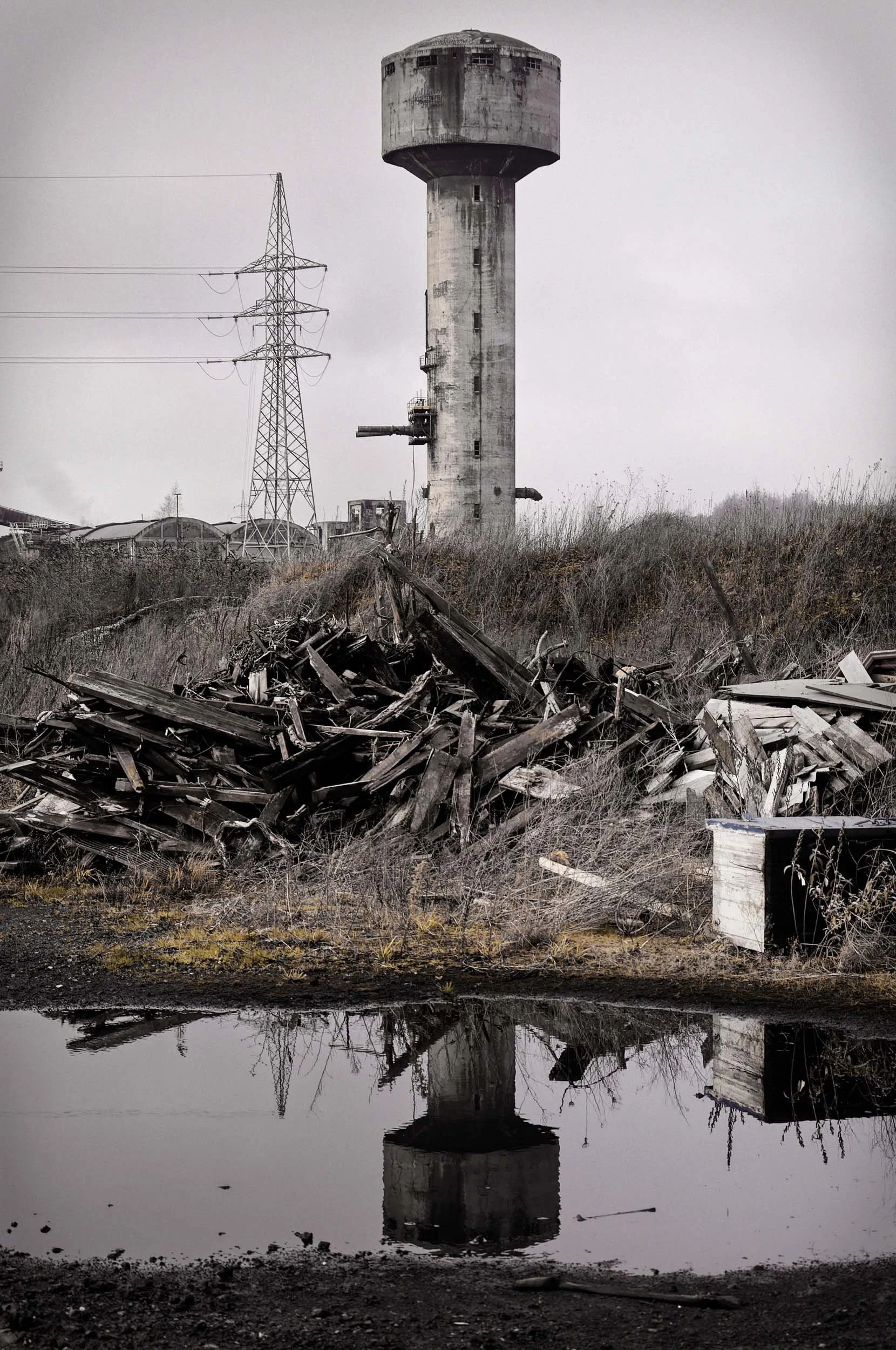
An abandoned, weathered water tower beside electrical power lines, with debris and overgrown grass in the foreground, and its reflection in a body of water.
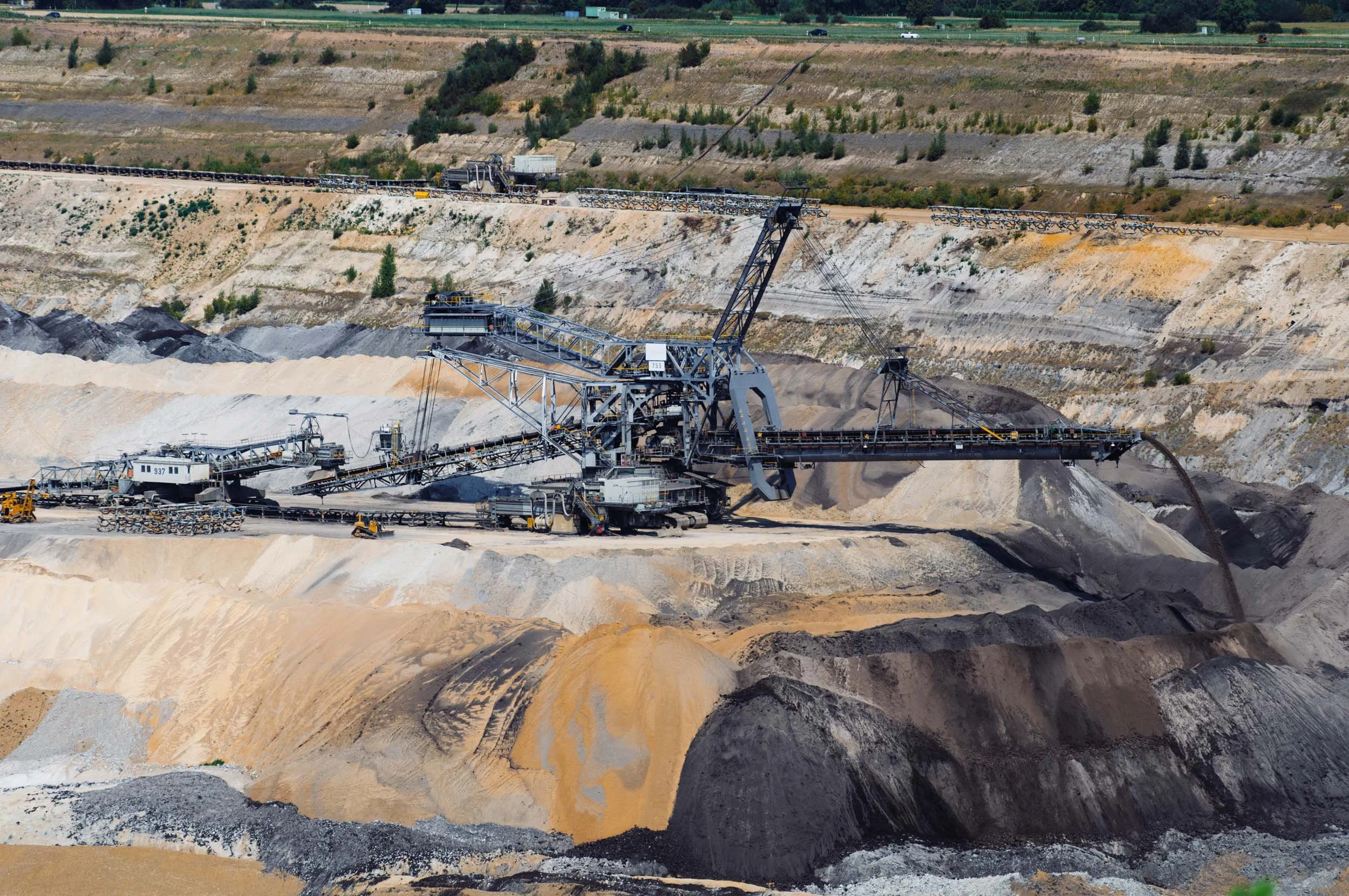
Open-pit mining operation with large machinery extracting minerals from the earth, multiple levels of excavation, and conveyor belts transporting the extracted material.
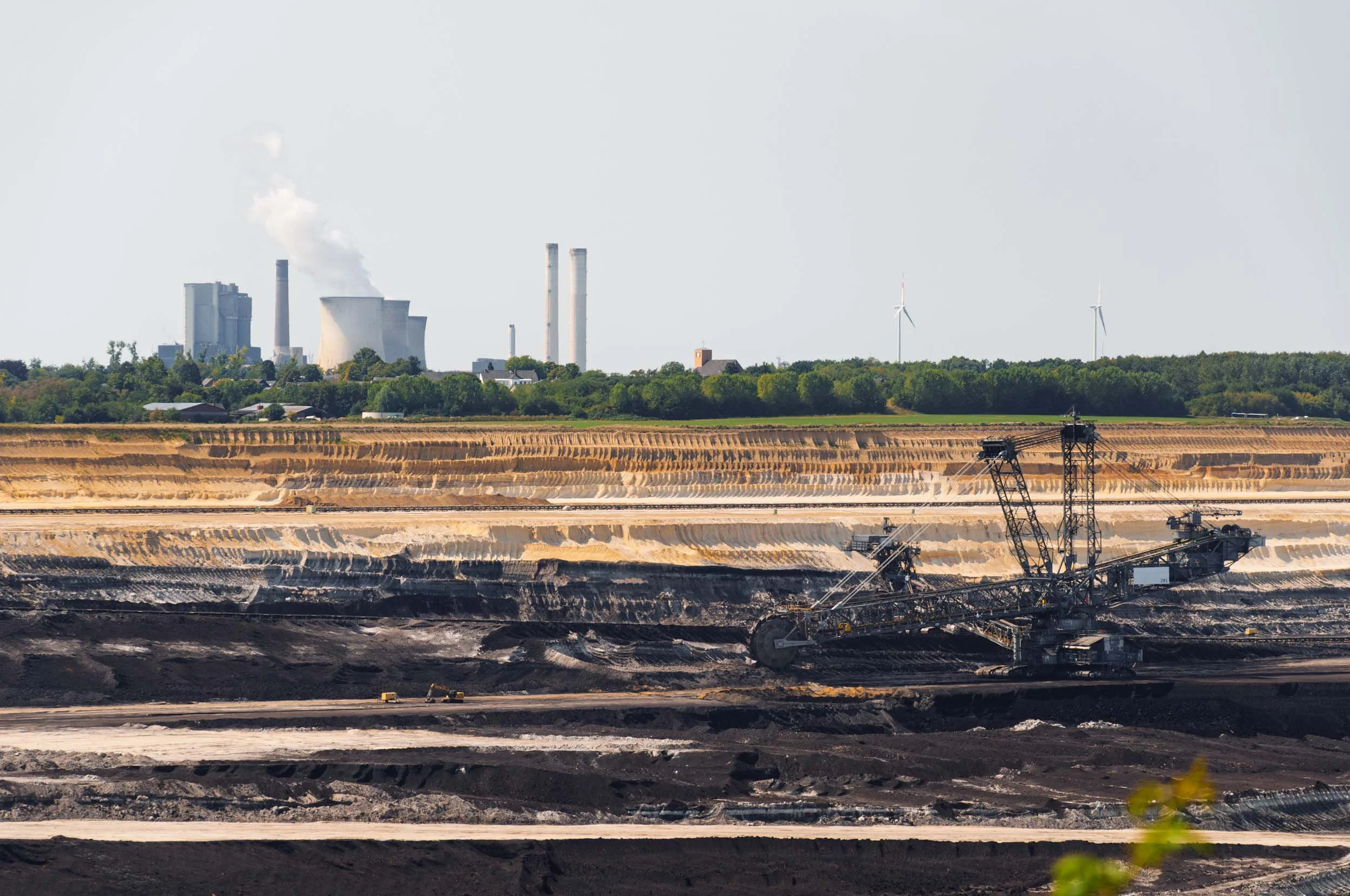
Open-pit coal mining operation with machinery digging into the earth, industrial buildings with cooling towers emitting steam, and wind turbines on the horizon.
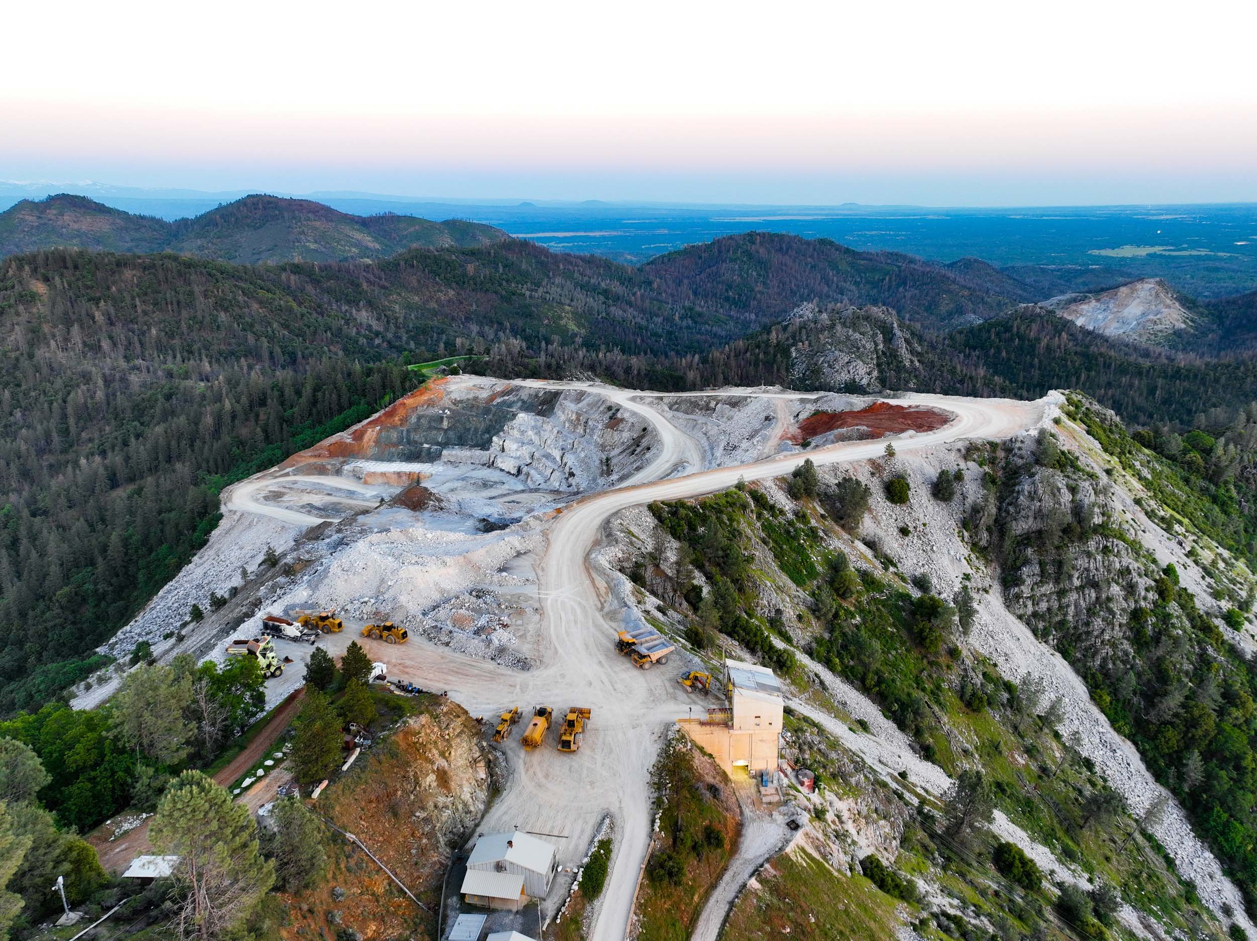
A mountain landscape with a quarry and construction vehicles in the foreground, surrounded by dense forests and rolling hills under a clear sky.
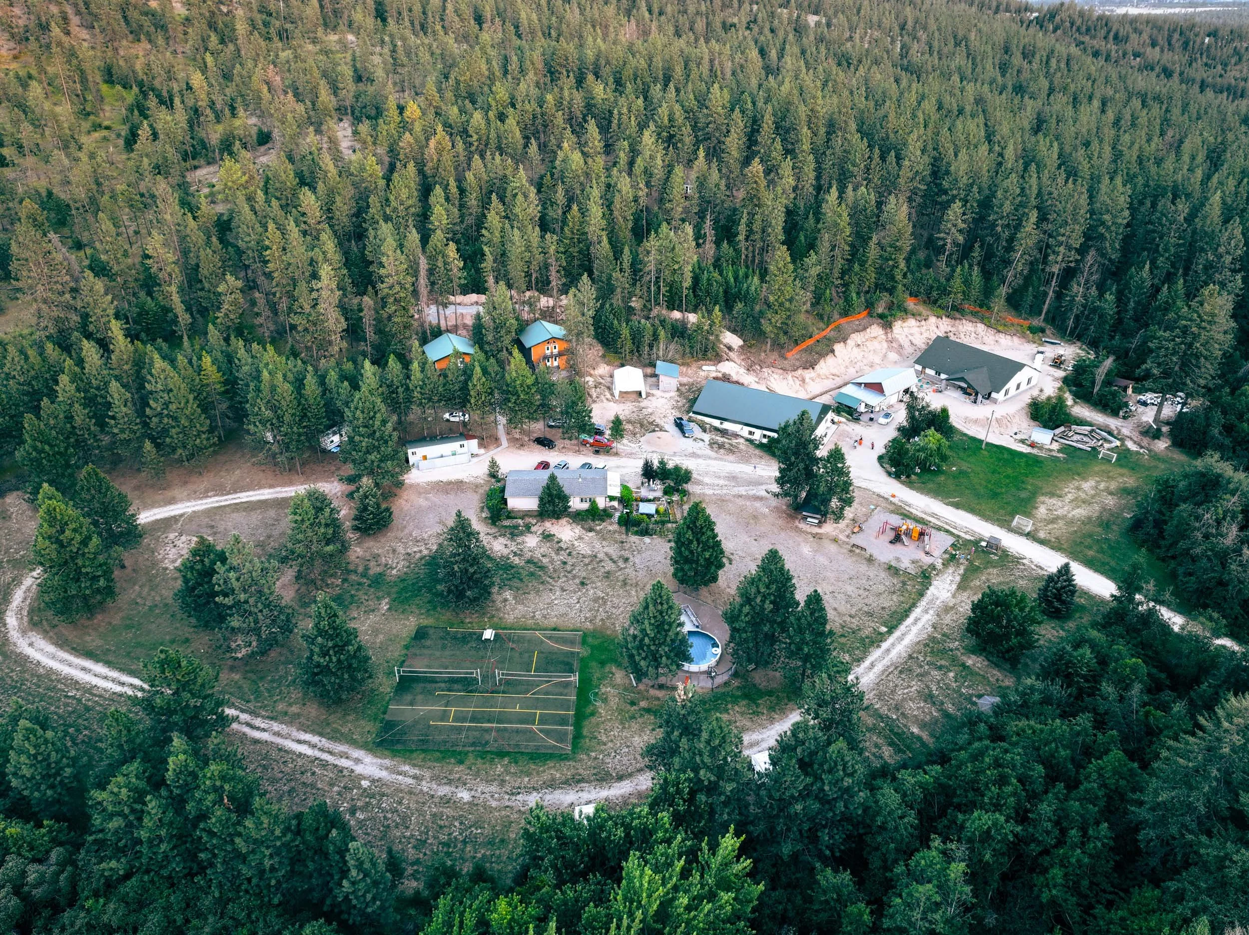
Aerial view of a residential area surrounded by dense green forest, with a few houses and buildings, a football field, a volleyball court, and a small playground.

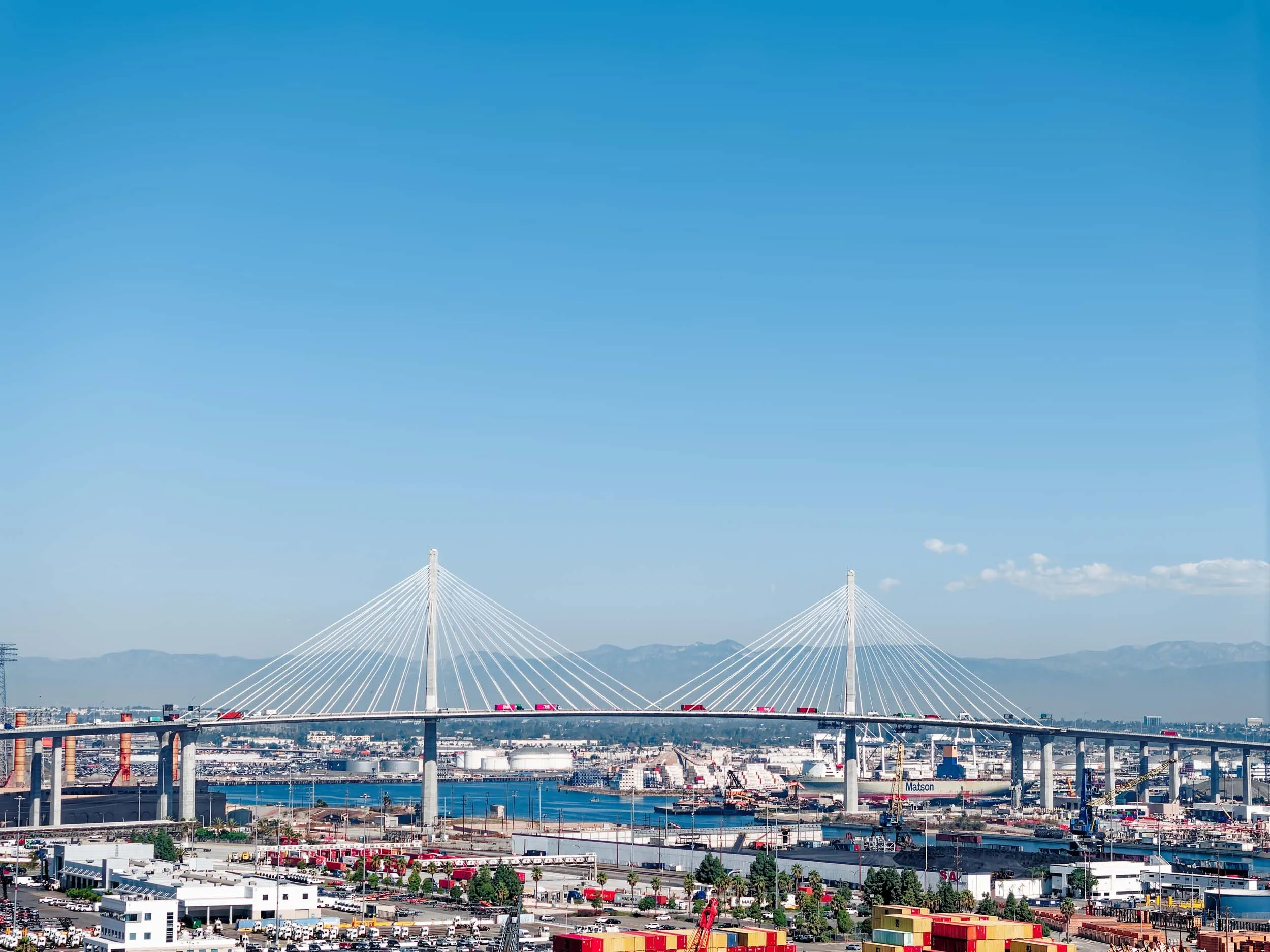
A large cable-stayed bridge with tall white towers and suspension cables stretches across a cityscape. Below, there are highways, buildings, and parking lots with mountains in the background under a clear blue sky.
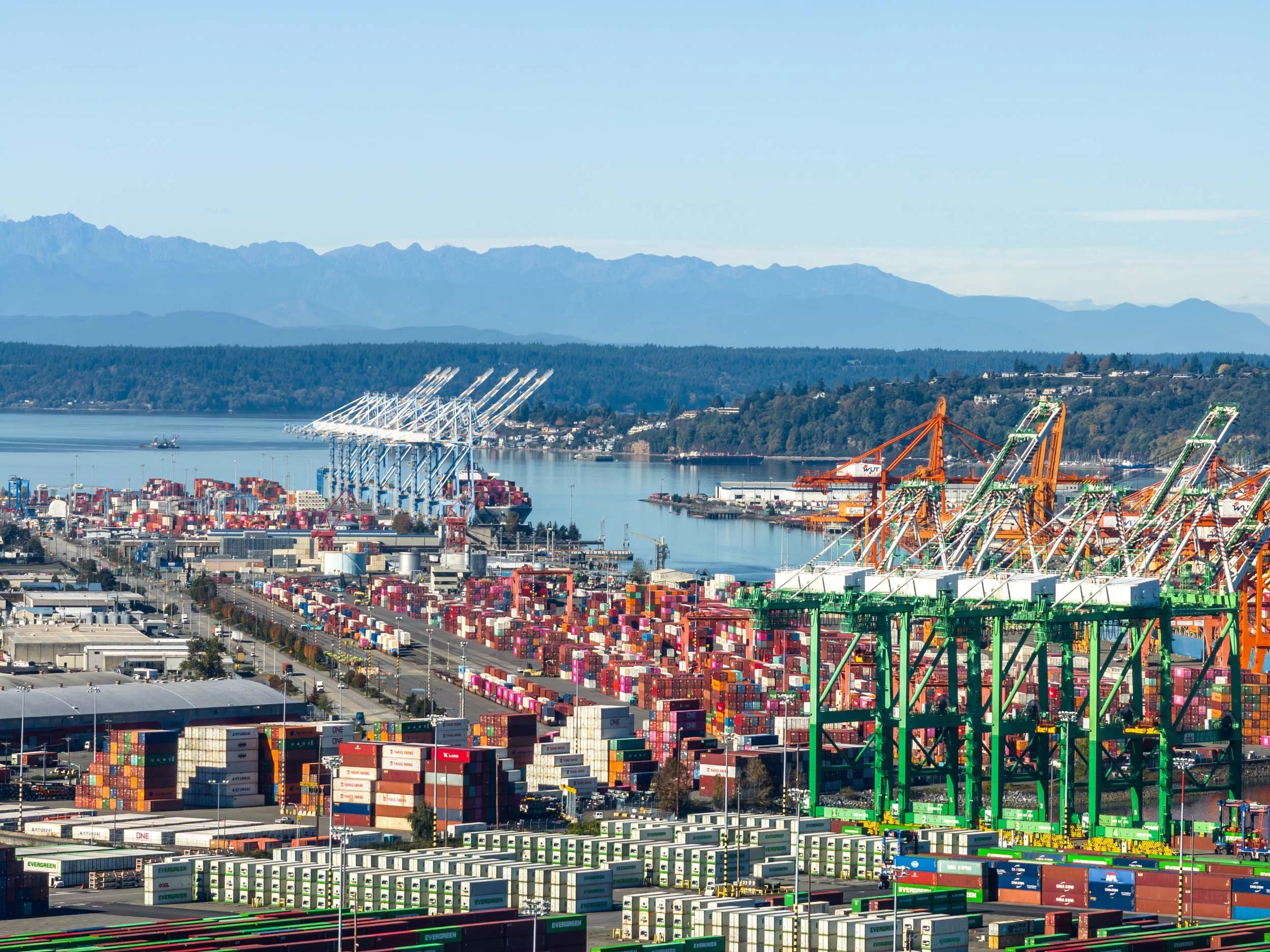
A port with numerous shipping containers stacked in rows, large cranes for loading ships, and distant mountains in the background.
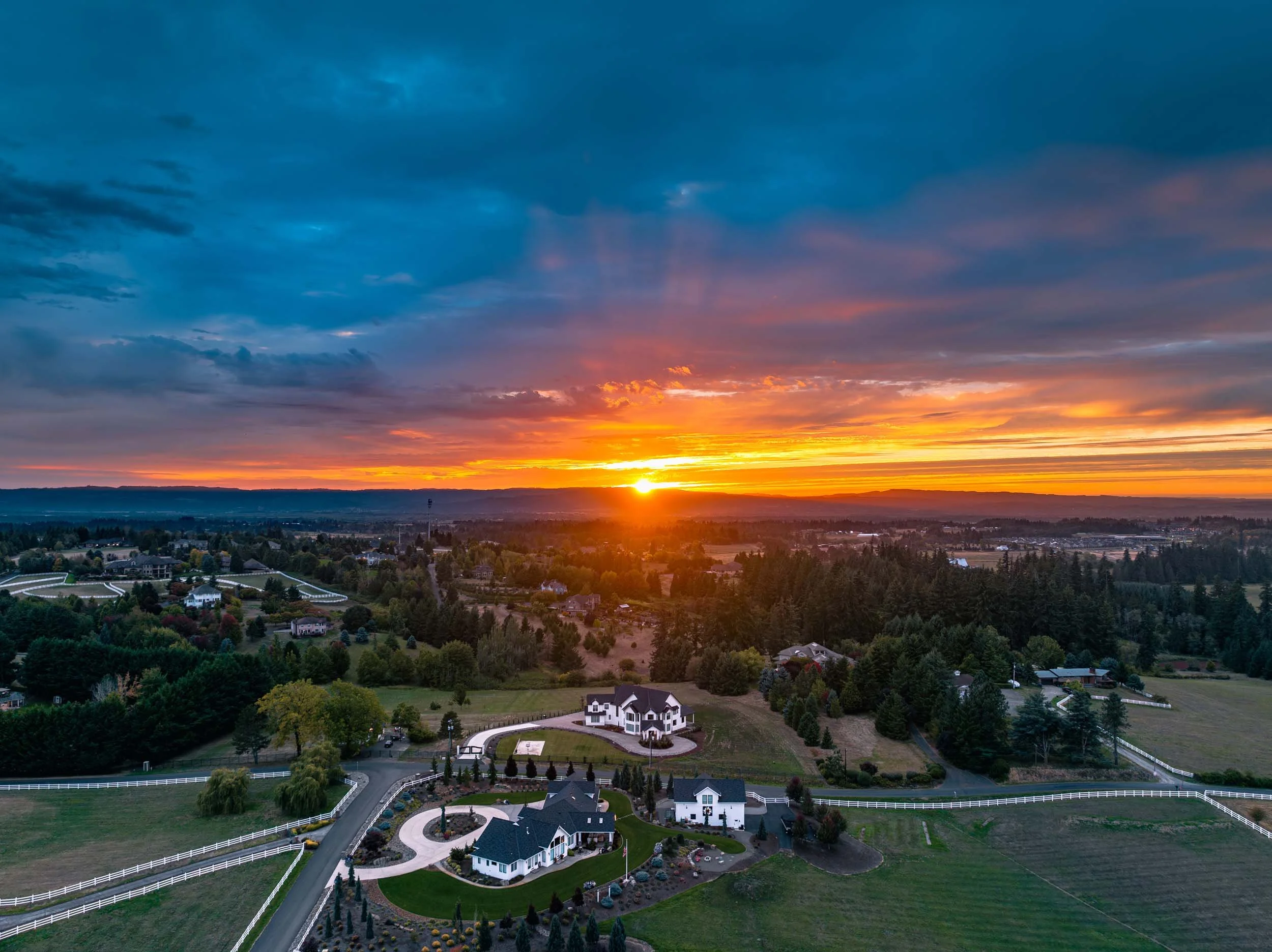
Sunset view over a suburban neighborhood with large houses, fenced yards, trees, and distant mountains under a colorful cloudy sky.